Bringing History to Life: WWI Project by JDSS Students
This project has been nominated as a finalist for the Governor General’s Award for Excellence in Teaching Canadian History, recognizing it as one of the top 20 history education initiatives in Canada!
We are excited to showcase an innovative project from École John Diefenbaker Senior School in Hanover, ON. Every year, grade 10 history students at JDSS trace the life of a local soldier from the West Grey area who enlisted during WWI. This year, the project took a modern twist with the integration of GIS mapping technology, transforming the learning experience into something even more dynamic and impactful.
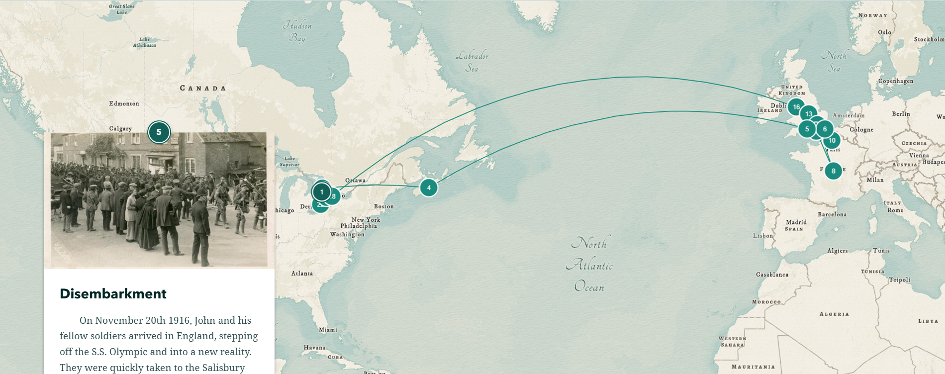
In Bringing History to Life: ArcGIS StoryMap WWI Soldier Project, local secondary school students tell the stories of local WWI soldiers using personnel files, various secondary sources and ArcGIS Story Maps.
StoryMaps is a tool created by ArcGIS that combines geospatial data with audio, photos, videos, and text to visualize sequential events or themes. Using StoryMaps, students were able to present their research in a dynamic and interactive format, creating detailed maps that trace the journeys and experiences of their assigned soldiers.
View Bringing History to Life below. Simply click the name of a soldier to learn their story and to recognize the remarkable work of these local Grade 10 History students.